A small town with Japanese colonial characteristics hidden in Taitung
隠された台東の日治時代の特徴的な町
Chenggong Township was formerly known as "Malolou," later renamed "Xingang," and after World War II, officially named "Chenggong." It is now the largest fishing port on Taiwan’s east coast. The origin of the name "Malolou" remains uncertain, but during the late Qing Dynasty, the area was inhabited and cultivated by the indigenous Amis people. In 1945, due to the prevalence of the name "Xingang" in multiple townships across Taiwan, the provincial government requested a name change. The township was renamed "Chenggong" in honor of national hero Koxinga (Zheng Chenggong), as the terrain resembled that of Anping Harbor and the name closely matched the local pronunciation of Chengguang'ao.
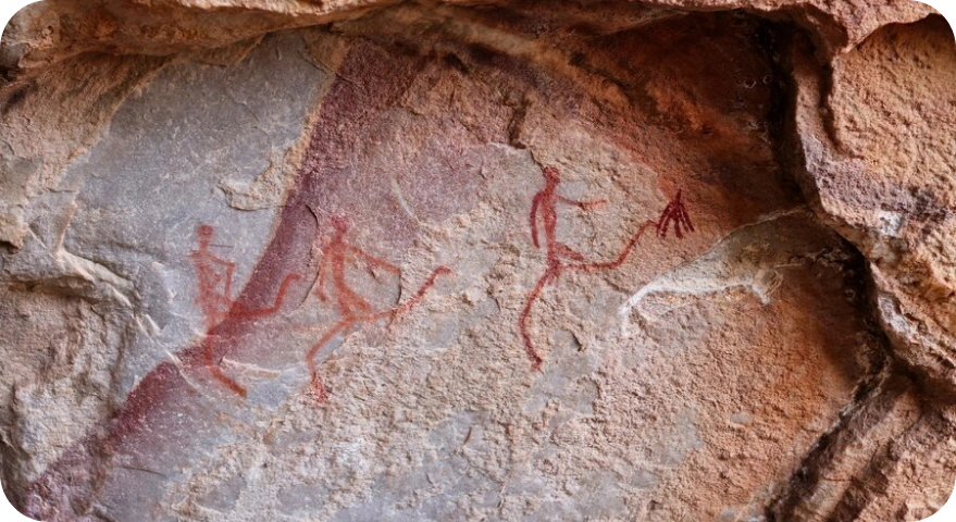
The prehistoric culture of Taiwan’s east coast dates back as far as 10,000 years, with the Changbin culture being one notable example. In the Chenggong area, archaeological discoveries such as stone walls, rock coffins, stone axes, sickles, and arrowheads, dated to around 3,500 years ago, are attributed to what is known as the "Qilin Culture" or "Megalithic Culture." Around 300 years ago, Amis people from Jingpu (in modern-day Hualien) and Beinan (in Taitung) migrated to this region. According to Fan-she An-naï (a Japanese-era record of indigenous settlements), the Amis people here originated from two groups: one that migrated south after losing battles against Qing forces, and another that fled attacks from the Beinan tribe. Generally, areas south of Zhitan are home to the Hengchun Amis, while areas north of Baishoulian are home to the Qilai Amis.
Han Chinese settlers began arriving during the Tongzhi era of the Qing Dynasty (1862–1875), initially settling in Chengguang'ao (later known as Xiaocuo or Xiaogang). By the late Tongzhi period, only five or six households were established. The area of Xiaogang was originally named "Xuangguang’ao," referring to the bay's shape resembling a crab's pincers. Following the Mudan Incident in 1874, the Qing government lifted the ban on mountain settlement and encouraged Han migration. More Han settlers began to move into Chengguang'ao.
Start of Japanese Rule
- 43 Han Chinese households (174 people) lived in the area, then called Chengguang'ao Village.
- Chengguang'ao Academy was established to educate local youth.
- Guang Heng Fa Trading Company was founded in 1916, becoming a key commercial hub in Taitung, selling rice, salt, and daily necessities.
Malolou Incident
- The Amis people, under oppression by Japanese authorities, revolted and killed Japanese police officers in Malolou (Chengguang'ao).
The Name "Chenggong" First Proposed
- The administrative center was moved from Chengguang'ao to Malolou.
- Malolou was renamed Xingang, and the Duli area was renamed Xingang District.
Xingang Fishing Port Construction
- Chengguang’ao District was abolished and merged into Xingang District, along with Sharuwan.
- Modern Chenggong Township borders were established.
- The completion of Xingang Fishing Port marked the rise of Chenggong as the largest fishing port in eastern Taiwan and strengthened its role as a regional center.
Renamed as Chenggong Township
- On February 1, the township officially adopted the name Chenggong.
- Major infrastructure development followed, contributing to the area's growth and modernization.
Influenced by tectonic plate activity, Chenggong Township has a rugged and complex terrain. Stretching longitudinally from north to south, it faces the Pacific Ocean to the east and is bordered by the densely forested Coastal Mountain Range to the west. The land slopes eastward, with most of the area consisting of mountains and hills. Coastal plains are narrow, with the Chenggong area having the broadest flatlands, known as one of the three major marine terraces along the East Rift Valley coast.
- Coastal Zone: Characterized by natural features such as bays, capes, beaches, sea cliffs, as well as unique landforms like marine terraces, potholes, uplifted coral reefs, and raised rock formations. The most famous scenic areas include Sanxiantai and Shiyusan (Stone Umbrella).
- Mountain Zone: The ridgeline of the Coastal Mountain Range is composed mainly of the towering and solid Dulanshan Formation. Eastward lies the Dagangkou Formation, rich in volcanic rocks and coarse breccia, forming gently sloping hills.
- Baishoulian Mountain
- Xingang Mountain – the highest point at 1,682 meters, also the tallest peak in the entire Coastal Mountain Range
- Qilin Mountain
Climate and Hydrology
Chenggong has a hot and rainy climate. Numerous streams run through the area, but they are generally short, fast-flowing, and have unstable water volume. These streams flow eastward from the Coastal Mountain Range into the Pacific Ocean.
Land Use and Change Over Time
During the Japanese colonial period, many settlers from western Taiwan came to cultivate the hilly terrain. However, due to changes in Taiwan's economic structure and transportation challenges, most of these areas have since been abandoned and reverted to forested wilderness.
Geographic and Ethnic Composition
Chenggong Township is long and narrow, stretching north to south along the coastal plain. The settlements established by various ethnic groups are arranged longitudinally from north to south, with the Amis people being the predominant indigenous group. The township consists of eight administrative villages, and the main occupations of the population are agriculture, followed by fishing.
Population Overview
As of February 2017 (Household Registration data), Chenggong Township had a population of 14,391, of which 7,624 were Amis people.
The Amis are a matrilineal society, naturally optimistic and pure-hearted. Their unadorned singing and primitive dance steps, accompanied by the sounds of the wind and ocean waves, reflect a lifestyle and ritual practice deeply intertwined with nature.
Cultural Highlight – The Harvest Festival (Ilisin)
The Harvest Festival is the cultural essence of the Amis and the most iconic event that represents their traditions. It plays a crucial role in the continuity of the tribe and the preservation of indigenous culture. Along the Chenggong coastline, there are 14 Amis villages, listed from south to north:
Xiaoma, Duli, Fengtian, Heping, Qilin, Minfeng, Sanmin, Zhitan, Sanxian, Meishan, Xiaogang, Yushuiqiao, Chong’an, and Yiwan.
Seasonal Festivities and Cultural Immersion
Every year from July to early August, each village selects a date to host its annual Harvest Festival. The vibrant atmosphere of dancing and singing fills the air, inviting travelers to fully immerse themselves in the unique and joyful spirit of Amis culture.
Economic Overview
Chenggong Township's economy is primarily based on agriculture and fisheries, with a relatively small portion attributed to commerce and industry, which are mainly concentrated around the Xingang area.
- Total cultivated land: 3,411.49 hectares
- Major crops: rice, corn, vegetables, citrus fruits, bamboo shoots, and coconuts
- The township actively promotes economic crops such as navel oranges and Valencia oranges to improve farmers' livelihoods.
- Total forested area: 7,654 hectares
- Key vegetation: bamboo, pine, and broadleaf trees
- Due to steep slopes and fast-flowing rivers that cause erosion and flooding, the township emphasizes reforestation and soil conservation as urgent priorities.
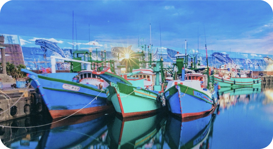
- Xingang Fishing Port is the largest fishing port on Taiwan's east coast, located along the Kuroshio and Oyashio currents, which provide abundant marine resources.
- Main fish species include: bonito, marlin, mahi-mahi, tuna, and sharks
- Other fishing ports: Xiaogang, Jihui, and Shiyusan Ao, though limited in scale due to natural and budget constraints.
- Aquaculture, especially white shrimp farming, is also growing rapidly.
- Dried bonito flakes, seafood, white shrimp, ponkan (winter tangerines), Valencia oranges, plums, Japanese apricots, and navel oranges are among Chenggong's renowned products.
- Nestled between mountains and the Pacific Ocean, Chenggong offers spectacular coastal rock formations, rugged mountains, and diverse ecological habitats, making it a destination that blends scenic beauty with rich biodiversity.
- Chenggong is also the most popular sea fishing location in Taitung County, thanks to its favorable geography and abundant marine life.
- The township is well-equipped with hotels, restaurants, gas stations, vehicle repair shops, and fishing gear stores, making it a hub for recreational sea fishing in eastern Taiwan.